

A large vintage 1950s (1959) sales promotion wall hanging map of the British Isles. Scale 1:633,600 or 10 miles per inch. Measures approx 150x170c...
Antique & Vintage Maps For Sale
232 item(s)
- List
- Grid
-
232 item(s)/page
![Confectionery.- [Nutt (Frederick)] The Complete confectioner; or, the whole art of confectionary,...](https://portal-images.azureedge.net/auctions-2024/forum-10422/images/e47bff62-dd8b-4418-9c9f-b171010dee96.jpg?h=175)
Lot 8
Confectionery.- [Nutt (Frederick)] The Complete confectioner; or, the whole art of confectionary,...
Confectionery.- [Nutt (Frederick)] The Complete confectioner; or, the whole art of confectionary, second edition, half-title, 10 engraved plates (...
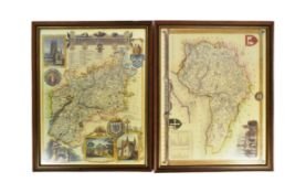
Two 20th Century reproduction maps of South-West interest, featuring a map of 'Somersetshire', dated '1836', and a map of 'Gloucestershire'. Both ...

Wall atlas about the war of 1866, map composed of several parts, mounted on linen, inscribed in detail upper right "Haack-Hertzberg, Großer Histor...

A collection of eleven 19th century maps of Russia and Siberia, some hand-coloured or with coloured borders. The lot including eight examples by J...

Lot 72
Gerard de Jode (Nimega 1509 - Anversa 1591), “Roman Empire - Four Kingdoms”. Lotto composto da
Gerard de Jode (Nimega 1509 - Anversa 1591), “Roman Empire - Four Kingdoms”. Lotto composto da quattro incisioni su carta, H cm 20x29 (difetti) ...

Lot 103
Purchas (Thomas) The Communicants duty. Set forth in eight sermons, preached at Kings-Lynne in No...
Purchas (Thomas) The Communicants duty. Set forth in eight sermons, preached at Kings-Lynne in Norfolk, woodcut head-pieces and decorative initial...

Lot 134
Darell (Rev. William) The History of Dover Castle, Southampton, for H. Hooper, 1786; and another (2)
Darell (Rev. William) The History of Dover Castle, engraved title with vignette, 8 engraved plates, folding engraved map, a few spots and some lea...

A collection of seven 20th century Conic Projection maps together with another. The lot to include: the map of Iran (Persia) scale 1:4,000,000 pla...

Lot 141
JAN DAVIDSZ DE HEEM (seguace di)
(Utrecht, 1606 - Anversa, 1684)Natura mortaOlio su tela, cm 80X112Provenienza: Probabilmente Parigi, Galleria Charpentier (1956, come attribuito a...

Lot 153
Schleswig Holstein. Nordfriesland. Original kolorierte Kupferstichkarte von Joh. Mejer aus C.
Schleswig Holstein. Nordfriesland. Original kolorierte Kupferstichkarte von Joh. Mejer aus C. Danckwerth, Newe Landesbeschreibung ..., 1652. 2 Kar...

Saxton, Christopher (c.1540-c.1610) & William Hole (d. 1624) - A 17th century etched & hand coloured map of Oxfordshire. The map reading: Oxoniens...

Lot 180
Churchill (Sir Winston Spencer) The British Gazette, nos. 1-8 (all published), 5 - 13th May, 1926
180Churchill (Sir Winston Spencer) The British Gazette, nos. 1-8 (all published), 5 - 13th May, 1926
Churchill (Sir Winston Spencer, editor) The British Gazette, nos. 1-8 (all published), loose as issued, light browning, some spotting, a few edges...

Lot 222
Alessandro Stefani Argentiere, Scatola ovale in argento con interno in vermeil, Bologna, XX secolo.
Alessandro Stefani Argentiere, Scatola ovale in argento con interno in vermeil, Bologna, XX secolo. Superficie riccamente lavorata a cesello e sba...

Lot 223
Gillray (James) New Morality, -or- The promis'd Installment of the High-Priest of the Theophilant...
Gillray (James) New Morality, -or- The promis'd Installment of the High-Priest of the Theophilanthropes, extended folding plate for the Anti-Jacob...

Lot 236
Britain.- Bartholomew (John) Bartholomew's New Reduced Survey Tourists & Cyclists, 36 maps of Bri...
Britain.- Bartholomew (John) Bartholomew's New Reduced Survey Tourists & Cyclists, 36 maps of British Isles, dissected and mounted on cloth, some ...

Britain.- Camden (William) Britannia, 4 vol., engraved plates and maps, heavily damp-stained with some defects, repairs and loss, ex-library copy ...

London.- Cary (John) Cary's New Pocket Plan of London, Westminster and Southwark, plan of London with keys below for 'Penny Post Receiving Houses'...

Lot 244
London.- Cary (John) Cary’s New and Accurate Plan of London and Westminster, the Borough of South...
London.- Cary (John) Cary’s New and Accurate Plan of London and Westminster, the Borough of Southwark and parts adjacent..., : viz. Kensington, Ch...

Lot 245
London.- Homann (Johann Baptist) Accurater Prospect und Grundris der Konigl: Gros - Britanisch: H...
London.- Homann (Johann Baptist) Accurater Prospect und Grundris der Konigl: Gros - Britanisch: Haupt und Residentz stadt London..., map of London...

Lot 246
London.- Langley (Edward, & Belch, William) Langley and Belch's New Map of London, engraved map, ...
London.- Langley (Edward, & Belch, William) Langley and Belch's New Map of London, first edition, map of London with 24 uncoloured engraved vignet...

Lot 247
London.- Newcourt (Richard), After. An Exact Delineation of the Cities of London and Westminster ...
London.- Newcourt (Richard), After. An Exact Delineation of the Cities of London and Westminster and the Suburbs Thereof..., plan of London and th...

Lot 248
London.- River Thames.- Tombleson (William) Tombleson’s Panoramic Map of the River Thames and Med...
London.- River Thames.- Tombleson (William) Tombleson’s Panoramic Map of the River Thames and Medway, vertical strip-map of the Thames from Cirenc...

Lot 262
India.- Laurie & Whittle (publishers) A New Map of the Jaghir Lands, on the Coast of Coromandel, ...
India.- Laurie & Whittle (publishers) A New Map of the Jaghir Lands, on the Coast of Coromandel, The Territory Belonging To The East India Company...

Lot 268
Voyages.- Dampier (William) A New Voyage Round the World... the Isthmus of America..., vol.1 (of ...
Voyages.- Dampier (William) A New Voyage Round the World... the Isthmus of America..., vol.1 (of 3), the third edition corrected, 5 engraved maps ...

David Michael Jones (1895-1974) Map of the Third Voyage wood engraving 19 x 16cm.

Lot 376
Reisen. Deutschlandkarte. Roost, J. B. Neue Wand – Karte von Deutschland den Königreichen Holland u.
Reisen. Deutschlandkarte. Roost, J. B. Neue Wand – Karte von Deutschland den Königreichen Holland u. Belgien und der Schweiz, sammt den angrenzend...

Lot 465
David Roberts Print
19th century A.D. Printed map of Egypt and Nubia with locations marked of the sketches of David Roberts, RA on his 1849 expedition; mounted in a g...

Vintage Breweriana interest Whitbread & Co Ltd metal pub map of Kent, 83cm x 57cm

rettangolare e ornato da grande cartouche floreale in marmi policromi diversi, in bordo filettato, montato su tavolo su base con cornice a legno p...

Quantity of Roleplaying maps & figures. Consisiting of paper & card maps to include Dungeons & Dragons, metal & plastic figures. Unchecked for com...

1st-4th century A.D. Mainly domestic ware fragments, mortaria, amphorae and other types; in a wooden collector's tray, some with inked inscription...

1st-4th century A.D. Including mainly rim fragments, one with the pouring lip; on marked 'Colchester / CM/23', another with 'Col / CM/19'. 1.64 k...

Claire Anne Khalil (American, b. 1944). Watercolor on paper painting titled "The Blue Room" depicting a flattened view of a bedroom, 1971. Signed,...

Lot 670
2 Jimmy Ernst Arboreal Artworks
Hans-Ulrich "Jimmy" Ernst (German/American, 1920-1984). Group of two artworks including:One drawing on board depicting an abstract arboreal figure...

Lot 685
Nine Edwardian coloured folding maps of Sussex farms including Pebsham Farm, Court Lodge Farm, Upper
Nine Edwardian coloured folding maps of Sussex farms including Pebsham Farm, Court Lodge Farm, Upper Wiltshire Farm and Catsfield Place Farm, each...

Lot 703
Barrow - General Chart Pekin
Asien.- Barrow, J. A general chart, on Mercator's Projection, to shew the track of the Lion and Hindostan from England to the Gulph of Pekin in Ch...

Danckwerth.- 6 kolorierte Kupferstichkarten von J. Mejer aus Danckwerth, Newe Landesbeschreibung, Husum, 1652 bzw. Amsterdam, Blaew, 1662. Je ca. ...

Danckwerth.- Konvolut von ca. 100 Kupferstichkarten (mit zahlreichen Dubletten) von J. Mejer aus Danckwerth, Newe Landesbeschreibung, Husum, 1652....

Lot 706
Braun-Hogenberg - Eckernförde
Eckernförde.- Ekelenforda antiquum Holsatiae ad Oceanum peninsulare oppidum. Kolor. Kupferstich von Braun u. Hogenberg, um 1590. 35 x 47 cm. Gerah...

Lot 709
Mejer - Sudertheill Gottorf
Gottorf.- Sudertheill des Amptes Gottorf. Kolor. Kupferstich von J. Mejer aus Danckwerth, 1652. 40 x 60 cm. Gerahmt.Das Gebiet nördlich der Eider,...

Holstein.- Holsatiae descrip. Altkolor. Kupferstichkarte von Marcus Jordanus bei Ortelius, 1585. 33,5 x 24 cm. Hinter Glas gerahmt.Die schöne Kart...

Adolf Stielers hand atlas with coloured maps

Sgt. John Lawrence "Larry" Frick (American, 1918-1992). Pen, ink, and graphite comic illustration captioned "Someone Stole the Horse" depicting tw...

Lot 720
Konvolut 25 Kupferstiche
Konvolut von 25 Kupferstichen meist mit Ansichten, u.a. aus Happel 'Des historischen Kerns'. Um 1680. Je ca. 15 x 20 cm. Jeweils unter Passepartou...

Lot 721
Konvolut von 18 Kupferstichen
Konvolut von 9 meist altkolor. Kupferstichkarten. Um 1650-1820. Meist je ca. 40 x 50 cm.Enthält: Doctecomius - Portugalliae (Falzdurchriss); Vissc...

Print titled "Mother's Tapestry" depicting a tapestry style composition of leaves and flowers with hand-painted white highlighting and gilt decora...

Lot 723
Speed - Kingdome of Denmarke
Speed.- The Kingdome of Denmarke. Altkolor. Kupferstichkarte von John Speed aus: A Prospect of the most famous parts of the World'. 1626. 39 x 51 ...

Lot 724
Mejer - Wagrien
Wagrien.- Wagriae Pars Septentrionalis cum praefectura Cismar et Oldenburgh. Kolor. Kupferstichkarte von J. Mejer, gestoch. von Ch. Rothgiesser, b...

Lot 727
Pair Fritz Eichenberg Woodcuts
Fritz Eichenberg (German, 1901- 1990). Pair of woodcuts including:One depicting St. Christopher with a child on his back, 1948. Pencil signed and ...

1st-4th century A.D. Irregular kiln slag fragments with various inclusions. 1.33 kg total, 4.6-12.4 cm (1 3/4 - 4 7/8 in.). Found Colchester, Ess...

Henri Toussaint (French, 1849-1911) after Eugene Delacroix (French, 1798-1863). Etching on laid paper titled "The Coast of Morocco" depicting a bo...

1st century A.D. Including burnished rim and base fragments, all but two with inked or pencilled reference notations including 'Col' for Colcheste...

Lot 1052
A Book
Titled Municipal Atlas of the Netherlands, by J. Kuyper, fifth part Zeeland by J Kuyper, fifth part Zeeland.


Lot 1375
A Collection of Maps
consisting of 3 floor plans, including Veere, largest 28 x 34 cm.


Lot 1396
A Map of Portugal and Spain
From Atlas Major by Frederick de Wit (1610 - 1698), 55 x 46 cm.

Mousterian Period, 200,000-30,000 B.C. Biconvex in section with narrow point. Cf. MacGregor, A. (ed.), Antiquities from Europe and the Near East i...