Highlight Keine Abbildung Los 829 WEST INDIES -- "OCCIDENTALIS AMERICAE PARTIS, vel, earum Regionum quas Christophorus Columbus primu 829WEST INDIES -- "OCCIDENTALIS AMERICAE PARTIS, vel, earum Regionum quas Christophorus Columbus primu Burgersdijk & Niermans WEST INDIES -- "OCCIDENTALIS AMERICAE PARTIS, vel, earum Regionum quas Christophorus Columbus primu[m] detexit (…)". (Frankfurt a/M.), Th. de Bry,... Auf die Merkliste Live
Keine Abbildung Los 82 Rare Bespoke Made Arts and Crafts Circa 1935 Enamel on Copper with Bronze Frame "Courage Alton Ales" 82Rare Bespoke Made Arts and Crafts Circa 1935 Enamel on Copper with Bronze Frame "Courage Alton Ales" Phixius Auctions Rare Bespoke Made Arts and Crafts Circa 1935 Enamel on Copper with Bronze Frame "Courage Alton Ales" Pub Plaque. From the ex Landlord of Alton Ale... Auf die Merkliste Live
Keine Abbildung Los 1167 Karten - Deutschland - - Pierre 1167Karten - Deutschland - - Pierre Jeschke Jádi Auctions Berlin GmbH Karten - Deutschland - - Pierre Mortier. Carte de la Mer d'Allemagne. 1693. Handcolorierter Kupferstich auf Bütten. 60,5 x 85 cm (64 x 92 cm). Pie... Auf die Merkliste Live
Keine Abbildung Los 1168 Karten - Europa - - A Ortelius. 1168Karten - Europa - - A Ortelius. Jeschke Jádi Auctions Berlin GmbH Karten - Europa - - A Ortelius. Descriptio Germaniae Inferioris. 1575. Handkolorierter Kupferstich. 37,5 x 50 cm. Unter Passepartout und hinter Gl... Auf die Merkliste Live
Keine Abbildung Los 1311 Mecklenburg-Vorpommern - - Friedrich 1311Mecklenburg-Vorpommern - - Friedrich Jeschke Jádi Auctions Berlin GmbH Mecklenburg-Vorpommern - - Friedrich Wilhelm Carl von Schmettau. Topographisch Oeconomisch und Militaerische Charte des Herzogthums Mecklenburg Sc... Auf die Merkliste Live
Keine Abbildung Los 1177 Karten - Seekarten - - Guillaume 1177Karten - Seekarten - - Guillaume Jeschke Jádi Auctions Berlin GmbH Karten - Seekarten - - Guillaume Dheulland. Carte Reduite de la Mer Mediterranée. 1737. Kupferstich auf Bütten. 60 x 53 cm (67 x 57 cm). Chez M. B... Auf die Merkliste Live
Keine Abbildung Los 842 Medizin - Ophthalmologie - - Hermann 842Medizin - Ophthalmologie - - Hermann Jeschke Jádi Auctions Berlin GmbH Medizin - Ophthalmologie - - Hermann Boerhaave. Praelectiones publicae de morbis oculorum. In hac secunda editione addita est Dissertatio anatomic... Auf die Merkliste Live
Keine Abbildung Los 1131 Europa - - Matthäus Merian. Theatri 1131Europa - - Matthäus Merian. Theatri Jeschke Jádi Auctions Berlin GmbH Europa - - Matthäus Merian. Theatri Europaei Eilffter Theil Oder: Außführlich fortgeführte Friedens- und Kriegs-Beschreibung : Und was mehr Von de... Auf die Merkliste Live
Keine Abbildung Los 430 framed decorative depiction of an antique map of the worldIngekaderde decoratieve voorstelling van 430framed decorative depiction of an antique map of the worldIngekaderde decoratieve voorstelling van DVC framed decorative depiction of an antique map of the worldIngekaderde decoratieve voorstelling van een antieke wereldkaart - 81 x 106 Auf die Merkliste Live
Keine Abbildung Los 219 AN OTTOMAN CARTOGRAPHIC MAP OF THE LEVANT 219AN OTTOMAN CARTOGRAPHIC MAP OF THE LEVANT Apollo Art Auctions Ottoman, Turkey, Ca. 19th century AD . A large and detailed Ottoman-era cartographic map, likely depicting the Levantine region, executed in blac... Auf die Merkliste Live
Mindestpreis nicht eingehalten Keine Abbildung Los 131 MAPS. DESCRIPTION DE L'ANCIENNE GAULE ALONG WITH PLAN OF MONTMEDY 131MAPS. DESCRIPTION DE L'ANCIENNE GAULE ALONG WITH PLAN OF MONTMEDY Auctioneum Ltd - East Bristol & Bath Maps:- France. Description de l'Ancienne Gaulle, along with an etched plan of the fort of Montmedy. The map hand coloured, engraved decorative bor... Auf die Merkliste Timed
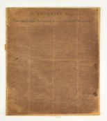
Mindestpreis nicht eingehalten Keine Abbildung Los 40 DECLARATION OF INDEPENDENCE. 20TH CENTURY FACSIMILE 40DECLARATION OF INDEPENDENCE. 20TH CENTURY FACSIMILE Auctioneum Ltd - East Bristol & Bath In Congress July 4, 1776. The unanimous Declaration of the thirteen United States of America. A 20th century - believed early to mid - facsimile d... Auf die Merkliste Timed
Mindestpreis nicht eingehalten Keine Abbildung Los 11 TWO MAPS OF THE UNITED KINGDOM, BEING ISLE OF ARRAN BY TIMOTHY PONT & DURHAM BY BLAEU 11TWO MAPS OF THE UNITED KINGDOM, BEING ISLE OF ARRAN BY TIMOTHY PONT & DURHAM BY BLAEU Auctioneum Ltd - East Bristol & Bath Maps:- two 17th century maps of the United Kingdom. Comprising a map of the Isle of Arran by Timothy Pont (arania Insula in aestuario Glottae Timo... Auf die Merkliste Timed
Mindestpreis nicht eingehalten Keine Abbildung Los 100 EGYPT. 1788 MAP OF EGYPT DRAWN FROM D ' ANVILLE'S ATLAS ENGR. J. HARRISON, UNFRAMED 100EGYPT. 1788 MAP OF EGYPT DRAWN FROM D ' ANVILLE'S ATLAS ENGR. J. HARRISON, UNFRAMED Auctioneum Ltd - East Bristol & Bath Map of Egypt. 1788 Egypt, called in the Language of the Country Missir; drawn from d' Anville's Atlas. Engraved for J. Harrison, No. 115 Newgate S... Auf die Merkliste Timed
Mindestpreis nicht eingehalten Keine Abbildung Los 130 SEA CHARTS. 1798 A CHART OF THE ENTRANCE OF THE RED SEA PUBL. LAURIE & WHITTLE 130SEA CHARTS. 1798 A CHART OF THE ENTRANCE OF THE RED SEA PUBL. LAURIE & WHITTLE Auctioneum Ltd - East Bristol & Bath Sea charts. 1798 A Chart of the Entrance of the Red Sea between the Coast of Arabia, ascertained by the Observations of Lieut. George Lewis in 176... Auf die Merkliste Timed
Mindestpreis nicht eingehalten Keine Abbildung Los 108 TWO MAPS OF PYEONGYANG Korea, Joseon period, 18th - 19th century (2) 108TWO MAPS OF PYEONGYANG Korea, Joseon period, 18th - 19th century (2) Bonhams TWO MAPS OF PYEONGYANG Korea, Joseon period, 18th - 19th century Ink and light color on paper, framed and glazed. 36 1/2 x 18 1/4in (92.7 x 46.4... Auf die Merkliste Timed
Mindestpreis nicht eingehalten Keine Abbildung Los 106 EARLY PUBLICATIONS OF ANDERSEN'S WORKS. A group of early Danish publications by Hans Christian A... 106EARLY PUBLICATIONS OF ANDERSEN'S WORKS. A group of early Danish publications by Hans Christian A... Bonhams EARLY PUBLICATIONS OF ANDERSEN'S WORKS. A group of early Danish publications by Hans Christian Andersen. Including: Flyvende post. Copenhagen: 1... Auf die Merkliste Timed
Mindestpreis nicht eingehalten Keine Abbildung Los 112 DANISH IMPRINTS OF ANDERSEN'S WORKS. A large group of works by Hans Christian Andersen in Danish. 112DANISH IMPRINTS OF ANDERSEN'S WORKS. A large group of works by Hans Christian Andersen in Danish. Bonhams DANISH IMPRINTS OF ANDERSEN'S WORKS. A large group of works by Hans Christian Andersen in Danish. Including: Improvisatoren. 1835. * Mulatten. 1... Auf die Merkliste Timed
Mindestpreis nicht eingehalten Keine Abbildung Los 113 DANISH IMPRINTS OF ANDERSEN'S WORKS. A large group of works by Hans Christian Andersen in Danish. 113DANISH IMPRINTS OF ANDERSEN'S WORKS. A large group of works by Hans Christian Andersen in Danish. Bonhams DANISH IMPRINTS OF ANDERSEN'S WORKS. A large group of works by Hans Christian Andersen in Danish. Including: En Digtes Bazar. 1842. * Eventyr fo... Auf die Merkliste Timed
Mindestpreis nicht eingehalten Keine Abbildung Los 137 Johan Friedrich Leonhard Dreier (Trondheim 1775-1833 Bergen) Views of Norway: Trondheim from the... 137Johan Friedrich Leonhard Dreier (Trondheim 1775-1833 Bergen) Views of Norway: Trondheim from the... Bonhams Johan Friedrich Leonhard Dreier (Trondheim 1775-1833 Bergen) Views of Norway: Trondheim from the East; A prospect of Molde; and Bergen from the So... Auf die Merkliste Timed
Keine Abbildung Los 193 John Stockdale, 1805 Antique Hand-Colored Map of Kent, England 193John Stockdale, 1805 Antique Hand-Colored Map of Kent, England Lion and Unicorn Original hand-colored copperplate engraving titled A Map of Kent from the best Authorities, published by John Stockdale on March 26, 1805. Engrave... Auf die Merkliste Live
Mindestpreis nicht eingehalten Keine Abbildung Los 48 Johann Babtiste Homann (1664 - 1724, Nürnberg) - Landkarte Kaspisches Meer und Kamtschatka, um 1720 48Johann Babtiste Homann (1664 - 1724, Nürnberg) - Landkarte Kaspisches Meer und Kamtschatka, um 1720 Wersching Auktionen Johann Babtiste Homann (1664 - 1724, Nürnberg) - Landkarte Kaspisches Meer und Kamtschatka, um 1720Mare Caspium altera Kamtzadaliam seu Terram Jed... Auf die Merkliste Timed
Keine Abbildung Los 789 ASIA -- "MAGNI MOGOLIS IMPERIUM". Amst., P. Schenk & G. Valk, (c. 1700). Cold 789ASIA -- "MAGNI MOGOLIS IMPERIUM". Amst., P. Schenk & G. Valk, (c. 1700). Cold Burgersdijk & Niermans ASIA -- "MAGNI MOGOLIS IMPERIUM". Amst., P. Schenk & G. Valk, (c. 1700). Cold. engr. map w. 2 cartouches 365 x 485 mm. -- Added: "Tab. XIII. Asiae... Auf die Merkliste Live
Keine Abbildung Los 795 FRANCE -- "LE MAINE". (Amst., H. Hondius, 1633). Handcold. engr. map. 370 x 795FRANCE -- "LE MAINE". (Amst., H. Hondius, 1633). Handcold. engr. map. 370 x Burgersdijk & Niermans FRANCE -- "LE MAINE". (Amst., H. Hondius, 1633). Handcold. engr. map. 370 x 500 mm. (Lower margin split on fold, lower right corner faintly staine... Auf die Merkliste Live
Keine Abbildung Los 807 LOW COUNTRIES -- "PASKAERTE VAN HET INKOOMEN VAN DE MAES, Tot aen 't 807LOW COUNTRIES -- "PASKAERTE VAN HET INKOOMEN VAN DE MAES, Tot aen 't Burgersdijk & Niermans LOW COUNTRIES -- "PASKAERTE VAN HET INKOOMEN VAN DE MAES, Tot aen 't Eylandt Roosenburgh als mede 't Inkoomen van 't Goereesche gat, tot aen Oude ... Auf die Merkliste Live
Keine Abbildung Los 820 SOUTH AMERICA -- BRAZIL -- "URBS SALVADOR [DE BAHIA]". (Amst., 1671). Engr. view in 820SOUTH AMERICA -- BRAZIL -- "URBS SALVADOR [DE BAHIA]". (Amst., 1671). Engr. view in Burgersdijk & Niermans SOUTH AMERICA -- BRAZIL -- "URBS SALVADOR [DE BAHIA]". (Amst., 1671). Engr. view in bird's eye perspective. 290 x 365 mm. From Montanus 'De Nieuwe... Auf die Merkliste Live
Keine Abbildung Los 827 WEST INDIES -- "NIEUWE KAART van het Eyland St. Eustatius in derzelver Ligging 827WEST INDIES -- "NIEUWE KAART van het Eyland St. Eustatius in derzelver Ligging Burgersdijk & Niermans WEST INDIES -- "NIEUWE KAART van het Eyland St. Eustatius in derzelver Ligging & Plantagien met de Naamen der Bezitteren". Amst., R. Ottens, 1775.... Auf die Merkliste Live
Keine Abbildung Los 794 EUROPE -- "CARTE GÉNÉRALE DES ROUTES DES CHEMINS DE FER et des principales 794EUROPE -- "CARTE GÉNÉRALE DES ROUTES DES CHEMINS DE FER et des principales Burgersdijk & Niermans EUROPE -- "CARTE GÉNÉRALE DES ROUTES DES CHEMINS DE FER et des principales voies navigables de l'Europe". Paris, J. Andriveau-Goujon, 1850. Steel-... Auf die Merkliste Live
Keine Abbildung Los 810 LOW COUNTRIES -- "TABULA NOVA PROVINCIÆ ULTRAJECTINÆ". (Amst.), N. Visscher/P. Schenk, n.d 810LOW COUNTRIES -- "TABULA NOVA PROVINCIÆ ULTRAJECTINÆ". (Amst.), N. Visscher/P. Schenk, n.d Burgersdijk & Niermans LOW COUNTRIES -- "TABULA NOVA PROVINCIÆ ULTRAJECTINÆ". (Amst.), N. Visscher/P. Schenk, n.d. (c. 1700). Engr. map on 2 conjoined sheets after B. du... Auf die Merkliste Live
Keine Abbildung Los 472 MAPS -- "AVRUPA, ASYA ve AFRIKA (…)". (Istanbul?), State Printing Office Matbaa-i Amire 472MAPS -- "AVRUPA, ASYA ve AFRIKA (…)". (Istanbul?), State Printing Office Matbaa-i Amire Burgersdijk & Niermans MAPS -- "AVRUPA, ASYA ve AFRIKA (…)". (Istanbul?), State Printing Office Matbaa-i Amire, dated 1254 (=1838/1839). Printed map of the (Holy) Ottoma... Auf die Merkliste Live
Keine Abbildung Los 804 LOW COUNTRIES -- "KAART VAN DE RIVIER DE LEK met zyn uiterwaarden, noorder 804LOW COUNTRIES -- "KAART VAN DE RIVIER DE LEK met zyn uiterwaarden, noorder Burgersdijk & Niermans LOW COUNTRIES -- "KAART VAN DE RIVIER DE LEK met zyn uiterwaarden, noorder en zuider dyken, van de Merwede beneden Krimpen, tot het Schoor van Hag... Auf die Merkliste Live
Keine Abbildung Los 815 SOUTH AMERICA -- "A NEW AND ACCURATE MAP of Peru and the Country 815SOUTH AMERICA -- "A NEW AND ACCURATE MAP of Peru and the Country Burgersdijk & Niermans SOUTH AMERICA -- "A NEW AND ACCURATE MAP of Peru and the Country of the Amazones, drawn from the most authentick French maps &c. and regulated by ... Auf die Merkliste Live
Keine Abbildung Los 475 MAPS -- KIEPERT, H. "Specialkarte vom Westlichen Kleinasien". Berlin, Verlag von Dietrich Reimer 475MAPS -- KIEPERT, H. "Specialkarte vom Westlichen Kleinasien". Berlin, Verlag von Dietrich Reimer Burgersdijk & Niermans MAPS -- KIEPERT, H. "Specialkarte vom Westlichen Kleinasien". Berlin, Verlag von Dietrich Reimer, 1890. Lithogr. map in 16 sections and 1 overview... Auf die Merkliste Live
Keine Abbildung Los 796 GREAT BRITAIN -- "THE ISLE OF MAN (…). Described by Tho Durham Ano. 1595 796GREAT BRITAIN -- "THE ISLE OF MAN (…). Described by Tho Durham Ano. 1595 Burgersdijk & Niermans GREAT BRITAIN -- "THE ISLE OF MAN (…). Described by Tho Durham Ano. 1595". Lond., J. Speed, 1610. Cont. handcold. engr. map decorated w. ships and... Auf die Merkliste Live
Keine Abbildung Los 817 SOUTH AMERICA -- "AMERICA MERIDIONALIS". (Amst., J. Hondius, 1619). Engr. map of South 817SOUTH AMERICA -- "AMERICA MERIDIONALIS". (Amst., J. Hondius, 1619). Engr. map of South Burgersdijk & Niermans SOUTH AMERICA -- "AMERICA MERIDIONALIS". (Amst., J. Hondius, 1619). Engr. map of South-America, cold. by hand, w. inset view of Cusco. 364 x 498 m... Auf die Merkliste Live
Keine Abbildung Los 806 LOW COUNTRIES -- LEIDEN -- "LUGDUNUM BATAVORUM". (Leiden), 1675. Engraved plan of the city 806LOW COUNTRIES -- LEIDEN -- "LUGDUNUM BATAVORUM". (Leiden), 1675. Engraved plan of the city Burgersdijk & Niermans LOW COUNTRIES -- LEIDEN -- "LUGDUNUM BATAVORUM". (Leiden), 1675. Engraved plan of the city by C. Hagen on 3 loose sheets: I. City map in bird's-ey... Auf die Merkliste Live
Keine Abbildung Los 797 LOW COUNTRIES -- "AMSTERDAM". (Frankfurt a/M., M. Merian, c. 1659). Engr. profile 797LOW COUNTRIES -- "AMSTERDAM". (Frankfurt a/M., M. Merian, c. 1659). Engr. profile Burgersdijk & Niermans LOW COUNTRIES -- "AMSTERDAM". (Frankfurt a/M., M. Merian, c. 1659). Engr. profile view of the city on 2 conjoined plates, w. 2 coats of arms and w... Auf die Merkliste Live
Keine Abbildung Los 801 LOW COUNTRIES -- BREDA -- "ARTILLERIE CAMP BY BREDA 1769". 's-Grav., I. du 801LOW COUNTRIES -- BREDA -- "ARTILLERIE CAMP BY BREDA 1769". 's-Grav., I. du Burgersdijk & Niermans LOW COUNTRIES -- BREDA -- "ARTILLERIE CAMP BY BREDA 1769". 's-Grav., I. du Mee, n.d. (c. 1769). Broadside, consisting of engr. in 2 parts dep. mil... Auf die Merkliste Live
Keine Abbildung Los 828 WEST INDIES -- "NIEUWE PASCAERT VAN WESTINDIEN de Vaste Kusten en de Eylanden 828WEST INDIES -- "NIEUWE PASCAERT VAN WESTINDIEN de Vaste Kusten en de Eylanden Burgersdijk & Niermans WEST INDIES -- "NIEUWE PASCAERT VAN WESTINDIEN de Vaste Kusten en de Eylanden". Amst., H. Doncker, n.d. (c. 1705). Engr. chart of the West Indies ... Auf die Merkliste Live
Keine Abbildung Los 793 EASTERN EUROPE -- POLAND -- "POLONIA ET SILESIA". (Amst., Mercator/Hondius, around or before 793EASTERN EUROPE -- POLAND -- "POLONIA ET SILESIA". (Amst., Mercator/Hondius, around or before Burgersdijk & Niermans EASTERN EUROPE -- POLAND -- "POLONIA ET SILESIA". (Amst., Mercator/Hondius, around or before 1595). Plain engr. map. 345 x 457 mm. -- Added: COLLE... Auf die Merkliste Live
Keine Abbildung Los 800 LOW COUNTRIES -- "ARNHEM". (The Hague, Topografische en Militaire Kaart v.h. Kon. der 800LOW COUNTRIES -- "ARNHEM". (The Hague, Topografische en Militaire Kaart v.h. Kon. der Burgersdijk & Niermans LOW COUNTRIES -- "ARNHEM". (The Hague, Topografische en Militaire Kaart v.h. Kon. der Nederlanden (TMK), (1850-64). 1 plain lithogr. map, scale 1:... Auf die Merkliste Live
Keine Abbildung Los 808 LOW COUNTRIES -- "PROVINCES UNIES DES PAYS BAS". (Paris), 1648. Engr. map by 808LOW COUNTRIES -- "PROVINCES UNIES DES PAYS BAS". (Paris), 1648. Engr. map by Burgersdijk & Niermans LOW COUNTRIES -- "PROVINCES UNIES DES PAYS BAS". (Paris), 1648. Engr. map by N. Sanson d'Abbeville, cold. by hand. 410 x 512 mm. Framed, under pas... Auf die Merkliste Live
Keine Abbildung Los 813 NORTH AMERICA -- "COLTON'S NEW RAILROAD & COUNTY MAP OF THE UNITED STATES, The 813NORTH AMERICA -- "COLTON'S NEW RAILROAD & COUNTY MAP OF THE UNITED STATES, The Burgersdijk & Niermans NORTH AMERICA -- "COLTON'S NEW RAILROAD & COUNTY MAP OF THE UNITED STATES, The Canadas &c.". NY, J.H. Colton, 1862. Steel engr. map within dec. fl... Auf die Merkliste Live
Keine Abbildung Los 822 WEST INDIES -- "CARTE RÉDUITE DES ISLES ANTILLES". (Par.), J.N. Bellin, 1758. Engr 822WEST INDIES -- "CARTE RÉDUITE DES ISLES ANTILLES". (Par.), J.N. Bellin, 1758. Engr Burgersdijk & Niermans WEST INDIES -- "CARTE RÉDUITE DES ISLES ANTILLES". (Par.), J.N. Bellin, 1758. Engr. sea chart in cont. col. 907 x 580 mm. Framed, under passeparto... Auf die Merkliste Live
Keine Abbildung Los 792 CASPIAN SEA -- "PROVINCIARUM PERSICARUM KILANIAE, nempe Chirvaniae Dagestaniae". Nürnberg, J.B. Homa 792CASPIAN SEA -- "PROVINCIARUM PERSICARUM KILANIAE, nempe Chirvaniae Dagestaniae". Nürnberg, J.B. Homa Burgersdijk & Niermans CASPIAN SEA -- "PROVINCIARUM PERSICARUM KILANIAE, nempe Chirvaniae Dagestaniae". Nürnberg, J.B. Homann, (c. 1720). Handcold. engr. map. 590 x 490 ... Auf die Merkliste Live
Keine Abbildung Los 791 BELGIUM -- "LEODIUM/LIEGE". (Cologne, Braun & Hogenberg, 1574). Engr. cold. by hand. 335 791BELGIUM -- "LEODIUM/LIEGE". (Cologne, Braun & Hogenberg, 1574). Engr. cold. by hand. 335 Burgersdijk & Niermans BELGIUM -- "LEODIUM/LIEGE". (Cologne, Braun & Hogenberg, 1574). Engr. cold. by hand. 335 x 484 mm. (Browned, outer right margin a bit brittle). Bi... Auf die Merkliste Live
Keine Abbildung Los 831 WORLD MAP -- "CARTE REDUITE DES PARTIES CONNUES DU GLOBE TERRESTRE, Dressée au 831WORLD MAP -- "CARTE REDUITE DES PARTIES CONNUES DU GLOBE TERRESTRE, Dressée au Burgersdijk & Niermans WORLD MAP -- "CARTE REDUITE DES PARTIES CONNUES DU GLOBE TERRESTRE, Dressée au Dépost des Cartes Plans et Journaux de la Marine pour le Service de... Auf die Merkliste Live
Keine Abbildung Los 473 MAPS -- "CARTE DE LA PARTIE SEPTENTRIONALE (& MÉRIDIONALE) de la Grèce Moderne dressée 473MAPS -- "CARTE DE LA PARTIE SEPTENTRIONALE (& MÉRIDIONALE) de la Grèce Moderne dressée Burgersdijk & Niermans MAPS -- "CARTE DE LA PARTIE SEPTENTRIONALE (& MÉRIDIONALE) de la Grèce Moderne dressée principalement sur les Mémoires de (F.-C.-H.-L.) Pouquevill... Auf die Merkliste Live
Keine Abbildung Los 802 LOW COUNTRIES -- "DUCATUS GELDRIÆ nova tabula". (Amst.), J. Ottens, n.d. (c. 1720 802LOW COUNTRIES -- "DUCATUS GELDRIÆ nova tabula". (Amst.), J. Ottens, n.d. (c. 1720 Burgersdijk & Niermans LOW COUNTRIES -- "DUCATUS GELDRIÆ nova tabula". (Amst.), J. Ottens, n.d. (c. 1720). Engr. map, cold. in outlines, w. large cartouche. 597 x 505 mm. Auf die Merkliste Live
Keine Abbildung Los 825 WEST INDIES -- "KAART VAN HET EILAND CURAÇAO benevens een plan van de 825WEST INDIES -- "KAART VAN HET EILAND CURAÇAO benevens een plan van de Burgersdijk & Niermans WEST INDIES -- "KAART VAN HET EILAND CURAÇAO benevens een plan van de stad en de haven". Amst., Wed. G. Hulst v. Keulen, 1836. Engr. map by D. Vee... Auf die Merkliste Live
Keine Abbildung Los 805 LOW COUNTRIES -- LEIDEN -- "LUGDUNI BATAVOR[UM] Leyden in Hollant". (Leiden), P. Bast 805LOW COUNTRIES -- LEIDEN -- "LUGDUNI BATAVOR[UM] Leyden in Hollant". (Leiden), P. Bast Burgersdijk & Niermans LOW COUNTRIES -- LEIDEN -- "LUGDUNI BATAVOR[UM] Leyden in Hollant". (Leiden), P. Bast, 1600. Engr. plan by Pieter Bast of the city w. large title/... Auf die Merkliste Live
Keine Abbildung Los 816 SOUTH AMERICA -- "A NEW AND ACCURATE MAP OF PERU, and the Country 816SOUTH AMERICA -- "A NEW AND ACCURATE MAP OF PERU, and the Country Burgersdijk & Niermans SOUTH AMERICA -- "A NEW AND ACCURATE MAP OF PERU, and the Country of the Amazones". (Lond., 1744). Engr. map after E. Bowen. 363 x 430 mm. -- "CAR... Auf die Merkliste Live
Keine Abbildung Los 790 BACHIENE -- COLLECTION of maps, taken from the 'Aanhangzel' (supplement) to 'Atlas, tot 790BACHIENE -- COLLECTION of maps, taken from the 'Aanhangzel' (supplement) to 'Atlas, tot Burgersdijk & Niermans BACHIENE -- COLLECTION of maps, taken from the 'Aanhangzel' (supplement) to 'Atlas, tot opheldering der hedendaagsche Historie (…)'. Amst., Schale... Auf die Merkliste Live
Keine Abbildung Los 830 WEST INDIES -- "PASKAERT VAN DE CAERIBES EYLANDEN alsmede vande vaste kust van 830WEST INDIES -- "PASKAERT VAN DE CAERIBES EYLANDEN alsmede vande vaste kust van Burgersdijk & Niermans WEST INDIES -- "PASKAERT VAN DE CAERIBES EYLANDEN alsmede vande vaste kust van caep Charles tot rio Oronoque en de bocht van Mexico". Amst., H. Do... Auf die Merkliste Live
Keine Abbildung Los 819 SOUTH AMERICA -- BRAZIL -- "LE BRESIL. Dont les côtes sont divisées en capitaineries 819SOUTH AMERICA -- BRAZIL -- "LE BRESIL. Dont les côtes sont divisées en capitaineries Burgersdijk & Niermans SOUTH AMERICA -- BRAZIL -- "LE BRESIL. Dont les côtes sont divisées en capitaineries". Paris, G. Danet, 1719. Engr. map by N. de Fer. 427 x 543 mm... Auf die Merkliste Live
Keine Abbildung Los 1044 NOLLI, GIOVANNI BATTISTA, BENEDETTI, IGNACIO: "La topografia di Roma di Gio Battista Nolli". 1044NOLLI, GIOVANNI BATTISTA, BENEDETTI, IGNACIO: "La topografia di Roma di Gio Battista Nolli". Dobiaschofsky Auktionen AG NOLLI, GIOVANNI BATTISTA (Castiglione d'Intelvi 1701 - 1756 Rom); BENEDETTI, IGNACIO (Italien, 18. Jh.) : "La topografia di Roma di Gio Battista N... Auf die Merkliste Live
Keine Abbildung Los 1072 WALSER, GABRIEL: "Canton Bern sive Illustris Helvetiorum Respublica Bernensis cum subditis suis et 1072WALSER, GABRIEL: "Canton Bern sive Illustris Helvetiorum Respublica Bernensis cum subditis suis et Dobiaschofsky Auktionen AG WALSER, GABRIEL (Wolfhalden 1695 - 1776 Berneck) : "Canton Bern sive Illustris Helvetiorum Respublica Bernensis cum subditis suis et confinibus re... Auf die Merkliste Live
Mindestpreis nicht eingehalten Keine Abbildung Los 177 Austrian Photografer around 1920 177Austrian Photografer around 1920 Art Antique Gallery & Auctioneers E. P. Deutsch Austrian Photographer around 1920, mountain views. Auf die Merkliste Timed
Mindestpreis nicht eingehalten Keine Abbildung Los 257 Geschichte des Siebenjährigen Krieges in Deutschland 257Geschichte des Siebenjährigen Krieges in Deutschland Art Antique Gallery & Auctioneers E. P. Deutsch Geschichte des Siebenjährigen Krieges in Deutschland, by Haude und Spener Berlin 1793. First volume. With map. In leather hard cover with gilded i... Auf die Merkliste Timed
Mindestpreis nicht eingehalten Keine Abbildung Los 259 Herbert Boeckl (1894-1966)-Graphic map 259Herbert Boeckl (1894-1966)-Graphic map Art Antique Gallery & Auctioneers E. P. Deutsch Herbert Boeckl (1894-1966)-Graphic map , with 19 black and white and coloured graphics. Numbered. On paper. In hard cover map. Edition around 1970... Auf die Merkliste Timed


![SOUTH AMERICA -- BRAZIL -- "URBS SALVADOR [DE BAHIA]". (Amst., 1671). Engr. view in](https://portal-images.azureedge.net/auctions-2025/burger10011/images/15f34e3b-6147-4b2c-aa54-b2b100ef2806.jpg?h=175)


![LOW COUNTRIES -- LEIDEN -- "LUGDUNI BATAVOR[UM] Leyden in Hollant". (Leiden), P. Bast](https://portal-images.azureedge.net/auctions-2025/burger10011/images/dcf24643-968e-4860-bc6f-b2b100ef15b9.jpg?h=175)


